


You’ve felt the itch to stare at a map and find a secret, right, that quiet thrill when a landscape suddenly makes sense, and the Negev dunes whisper promises of lost roads and ruins you’ll want to walk toward.
Stay with me, you’ll get a guided mapping of the Negev dunes to named sites like Avdat and Shivta, surprising archaeological layers, and recent finds that change the desert’s story, plus practical notes if you plan to chase these ruins yourself.
How the Negev Dunes Mask Old Caravan Arteries
Think about tracks hidden under windblown sand, they exist and they’re mappable when you know where to look.
Why Satellite Views Reveal the Negev Dunes Secrets
High-res imagery exposes faint roadbeds and settlements, letting archaeologists trace the spine of Byzantine and Nabatean caravan routes that once threaded this desert, and yes, layers of occupation show up when you overlay old maps with modern photos.
Avdat and Shivta: Named Ruins That Reshape the Map
These aren’t anonymous piles of stones, Avdat and Shivta tell human stories, think markets, inns, and sudden abandonments that freeze moments in time.
- Avdat’s Nabatean acropolis and Byzantine churches
- Shivta’s agricultural terraces and wine presses
- Nearby small waystations, often overlooked
These bullet points hide dense evidence, Avdat and Shivta anchor caravan narratives, their architecture signals trade networks and seasonal life in a place many assume was empty.
Recent Finds That Force a Rethink of Desert Life
Archaeologists keep pulling surprises from sand, and each find nudges us away from the lonely-desert myth toward a complex human landscape.
New Inscriptions and What They Reveal in the Negev Dunes
Graffiti, inscriptions, and small artifacts dated to Roman and Byzantine eras are rewriting timelines, showing longer, denser occupation, and connecting trade, pilgrimage, and imperial administration in ways textbooks often missed.
Practical Mapping Tips, and a Simple Comparison Table
Ponder this, maps are only as useful as the details you search for, below is a compact comparison to orient you before you go exploring.
| Site | Primary Era | Visible Features |
|---|---|---|
| Avdat | Nabatean to Byzantine | Fortress, churches, road traces |
| Shivta | Byzantine | Wine presses, terraces, chapels |
| Caravan Waystations | Roman to Byzantine | Foundations, cisterns, pottery thin deposits |
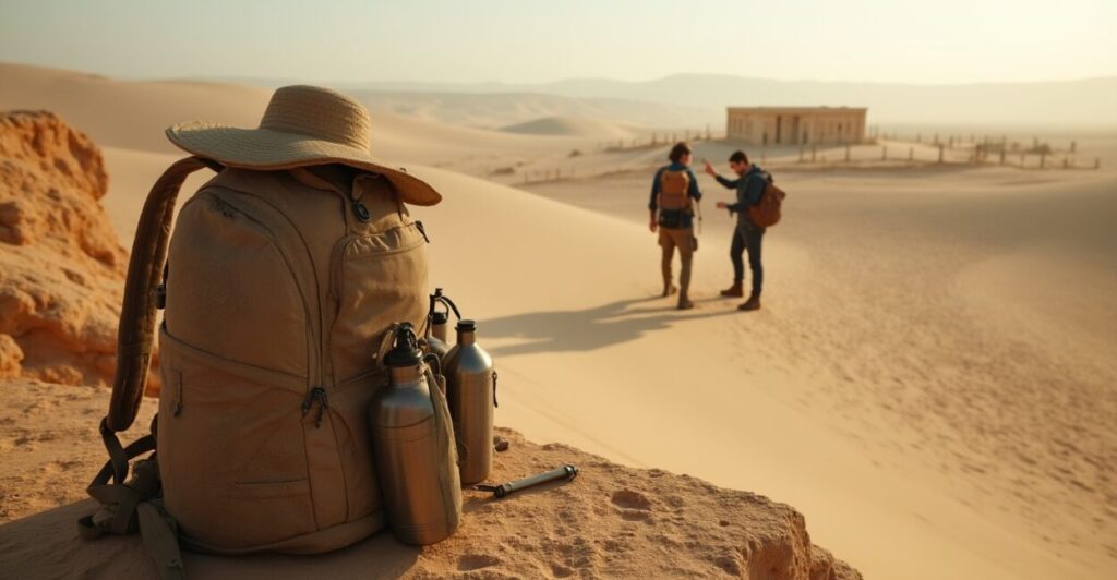
Fieldwork Realities: What to Pack and What to Avoid
Here’s the hard truth, the desert looks romantic but behaves like a strict teacher, so prepare smart.
- What to avoid: going alone on unmarked sand tracks
- What to avoid: assuming every ruin is accessible without permission
- What to avoid: underestimating water and heat
Avoiding these mistakes keeps you safe and legal, many sites are protected and require permits, and the Negev’s microclimates can flip a comfortable morning into a risky afternoon fast.
Where to Read More and Trusted Research Portals
If you want to dive deeper, check authoritative sources that publish excavation reports and GIS studies.
For primary research consult Biblical Archaeology and official entries like the Israel Antiquities Authority and university publications, together they provide excavation updates and site maps useful for planning visits.
- Academic journals and university reports
- Government conservation portals
- High-resolution satellite archives
These resources let you cross-check claims, confirm recent finds, and often include downloadable maps and permit procedures, which is essential before you commit to a trip.
How This Rewrites the Story for Travelers and History Buffs
Here is the secret, the Negev dunes aren’t empty, they are layered storybooks, each ruin a chapter you can read if you know where to open the cover.
Experience-focused Routes Through the Negev Dunes
Follow mapped caravan corridors from Avdat to Shivta, take detours to lesser-known waystations, and you’ll feel the pulse of trade and pilgrimage, these routes let you sense connectivity rather than isolation, turning a hike into a moving museum.
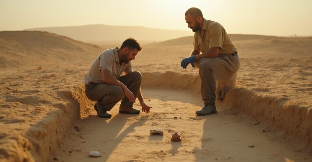
Common Field Methods Archaeologists Use
Survey teams combine surface collection, drone imaging, and test trenches to build chronologies, these methods reveal subtle occupation phases and are why recent discoveries changed interpretations of desert settlement density.
- Basic gear checklist for a day survey
- Navigation tools and permit reminders
- Respect and conservation guidelines
Gear, maps, and respect for conservation laws make the difference between a meaningful field visit and accidental damage, and being prepared also deepens your understanding of the sites you visit.
Ongoing Debates and the Discoveries to Watch Next
Archaeology loves a good argument, and the Negev produces them, especially about trade intensity and habitation cycles.
- Intensity of caravan traffic through different eras
- Role of climate change in abandonment
- Connections between nomadic and settled populations
These debates matter, they shape how we interpret ruins like Avdat and Shivta, and upcoming publications will likely refine timelines and reveal more small sites that stitch the big picture together.
Conclusion
You’ve just seen how the Negev dunes hide a network of named ruins and caravan routes that change the desert from empty to storied, and those revelations come with real maps, permit rules, and surprising artifacts.
Go curious, but go prepared, and when you stand on a dune above Avdat or Shivta, you’ll see not emptiness but a crossroads of human lives, trade, and surprising continuity that many overlook.
Can I Visit Avdat and Shivta Freely?
Most visitors can access Avdat and Shivta during daylight with reasonable ease, but parts of the sites may be restricted for conservation or research, check the Israel Antiquities Authority for current access rules, and always follow posted guidelines to protect fragile remains and permit ongoing archaeological work.
How Do Recent Finds Change Our View of the Negev Dunes?
New inscriptions, pottery assemblages, and satellite-detected roadbeds suggest denser occupation and sustained trade across Roman and Byzantine periods, these finds challenge the idea of a sparsely used desert and point to integrated networks connecting the Negev to broader Mediterranean economies and inland markets.
What Practical Steps Should I Take Before Exploring Caravan Routes?
Plan with maps and permits, hire a local guide for unmarked routes, inform authorities of your plans, carry ample water and navigation tools, and respect conservation rules; preparation reduces risk and enhances the experience, letting you focus on the archaeological story rather than logistics.
Are There Recent Publications or Databases for Mapping These Sites?
Yes, university archaeological reports and government databases publish GIS datasets and excavation summaries, check university archaeology departments and the Israel Antiquities Authority online repositories for updated site maps, reports, and sometimes downloadable geospatial files to help plot routes safely and informatively.
How Reliable Are Satellite Maps for Finding Buried Caravan Roads?
Satellite imagery is a powerful tool when combined with ground-truthing, it highlights linear anomalies and settlement patterns but must be validated by on-site survey or excavation, remote sensing narrows the search area, then archaeologists confirm dates and functions through artifacts and stratigraphy.