


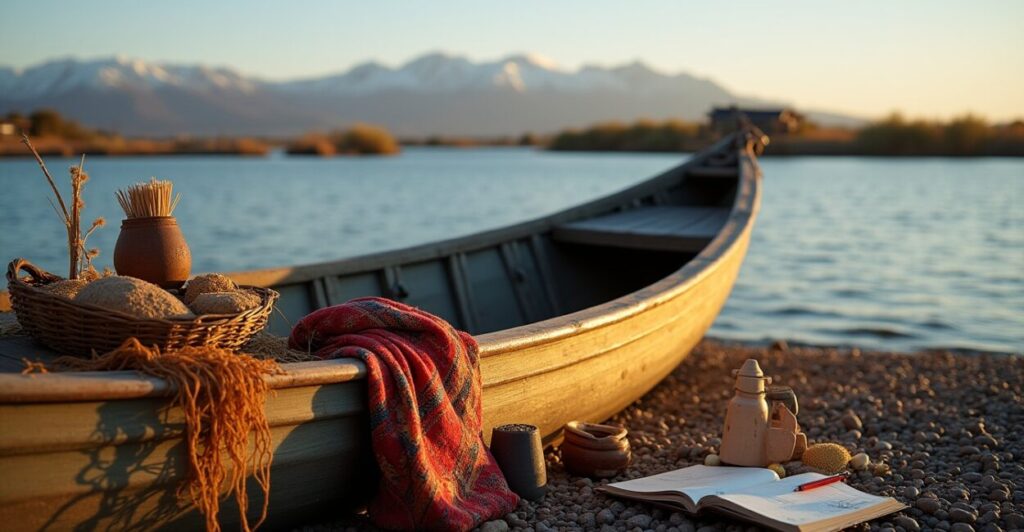
Lake Titicaca sits like a high-altitude mirror between Bolivia and Peru, holding centuries of stories, island communities, and fragile shorelines. This lake’s shifting edges have real human impact, especially on Amantani and Taquile islands where residents are adapting fast.
Recent shoreline changes and community measures at Lake Titicaca are prompting local action, tourism shifts, and scientific attention. This article maps what’s changing, why it matters, and how islanders and visitors can respond.
Read on to discover practical measures, research highlights, and local voices from Lake Titicaca—plus clear tips for travelers and conservation-minded readers.
Current Shoreline Shifts and Why They Matter
Visible Changes Along the Coast
Shoreline retreat and intermittent flooding have altered beaches and docks on Lake Titicaca, affecting farms and walking paths. Local fishermen have noticed submerged moorings.
These changes disrupt daily life and tourism on islands like Amantani and Taquile, changing access to markets, schools, and freshwater sources.
Why Even Small Shifts Are Critical
Lake Titicaca’s high-elevation ecology is sensitive; minor shoreline change can cascade into crop loss, salt intrusion, and cultural site damage. Communities face tangible economic risks.
Scientists link variability to changing rainfall patterns, glacial melt and water management upstream—connecting local hardship to broader climate trends.
Community Responses on Amantani and Taquile
Local Adaptation Strategies
- Relocating family gardens higher up terraces
- Rebuilding and raising communal docks
- Rotating grazing lands to reduce erosion
- Strengthening traditional stone terraces and reed barriers
Island councils coordinate seasonal planting adjustments and infrastructure repairs. These actions mix ancestral practice with pragmatic urgency.
Social Cohesion and Collective Action
Communities on Amantani and Taquile emphasize shared labor—minka-style work—to repair shorelines and rebuild paths quickly after high water.
Collective festivals and tourism revenue-sharing help finance repairs, reinforcing social bonds as a resilience strategy.

Scientific Findings and Monitoring Efforts
Remote Sensing and Local Observation
Satellite imagery and local reports together reveal shifting shorelines and water-level anomalies over recent years. Data helps prioritize urgent spots for action.
Researchers combine high-res photos with community mapping to create practical response plans that respect local knowledge.
Key Research Priorities
Scientists focus on hydrology, sediment transport, and impacts from upstream water use. Understanding precipitation patterns is crucial for predicting future shoreline change.
Long-term monitoring stations and cooperative programs are expanding to provide better early warnings for island residents.
Practical Tips for Visitors and Responsible Tourism
How Travelers Can Minimize Impact
- Use established docks; avoid trampling shore vegetation
- Book homestays that support local economies
- Follow waste rules and carry out all litter
- Hire local guides to learn respectful behavior
Tourists who respect fragile island systems help sustain livelihoods and reduce shoreline stress. Responsible choices matter.
When to Visit and What to Expect
Water levels and dock access can vary by season; check local updates before traveling. Expect rustic conditions and warm community welcomes on Lake Titicaca.
Plan flexible itineraries and allow extra time for boat transfers—community measures may require adjusted schedules.
Economic and Cultural Impacts on Island Life
Livelihood Shifts and Adaptations
Rising uncertainty pushes families to diversify income—more handicrafts, tourism services, and alternative crops. This reshapes age-old livelihoods around Lake Titicaca.
Some households balance fishing with guest hosting, blending income streams that cushion against shoreline-driven losses.
Cultural Preservation Amid Change
Communities work to preserve rituals and sites even as physical access changes. Traditional festivals and textile weaving remain central to identity.
Local schools incorporate environmental education so younger generations steward both culture and landscape.
Policy, Support and External Resources
Government and Ngo Interventions
Regional governments and NGOs fund shoreline reinforcement and water management projects. Grants often target community-led initiatives on Lake Titicaca.
Coordination between Bolivia and Peru is vital given shared watershed governance and transboundary impacts on island communities.
Practical Resource Table
| Type | Provider | How it helps |
|---|---|---|
| Monitoring data | NASA | Satellite imagery to track shoreline shifts |
| Community grants | UNEP | Funding for adaptation and sustainable livelihoods |
| Local networks | IADB | Technical and financial support for coastal resilience |
Practical Next Steps for Residents and Advocates
Immediate Actions for Communities
- Map most-affected shorelines and prioritize repairs
- Secure shared funds for docking and terrace reinforcement
- Train volunteers in safe boat handling and emergency response
- Strengthen market links to stabilize income (step-by-step)
Prioritizing actions reduces risk and preserves daily life. Clear, local plans unlock external funding and technical help.
How Outsiders Can Support Effectively
Donors and visitors should partner with local councils, respect cultural protocols, and fund long-term resilience rather than short-term fixes.
Support that builds local capacity—training, equipment, monitoring—yields sustainable results on Lake Titicaca.
Conclusion
Lake Titicaca’s shoreline shifts challenge centuries-old island life but also reveal resilient communities forging practical solutions. Amantani and Taquile show how local knowledge, collective action, and targeted support can protect culture and livelihoods.
By connecting scientific insight, responsible travel, and community-led adaptation, we can help preserve the lake’s future and the people who call its islands home—just as the opening image of a changing shore asked us to do.
Faq
What is Causing Shoreline Changes at Lake Titicaca and Specifically on Amantani and Taquile?
Shoreline changes result from a mix of altered rainfall patterns, glacial melt affecting inflows, and local water management upstream. On Amantani and Taquile, these factors combine with wind-driven waves and shoreline erosion, damaging docks, terraces, and gardens and prompting urgent local adaptation measures and monitoring efforts.
How Are Island Communities Adapting to Protect Homes and Livelihoods?
Communities are raising docks, reinforcing terraces with traditional stonework, relocating gardens to higher ground, and organizing collective labor. They also diversify incomes through tourism and crafts while partnering with NGOs and governments for funding, monitoring systems, and technical assistance to strengthen long-term resilience.
Can Visitors Still Travel to Lake Titicaca Safely and Responsibly?
Yes, travel is possible but requires flexibility: docks and schedules may change because of water-level shifts. Travelers should book flexible transfers, hire local guides, support homestays, avoid damaging shoreline vegetation, and follow community guidance so tourism remains beneficial and low-impact.
What Scientific Efforts Are Underway to Monitor Changes and Inform Policy?
Researchers use satellite imagery, local observation networks, and hydrological studies to detect shoreline shifts and water-level trends. International agencies and academic institutions collaborate with communities to create early-warning systems, prioritize interventions, and inform binational water governance policies for Lake Titicaca.
How Can People and Organizations Support Long-term Resilience on Lake Titicaca?
Support practical community-led projects: fund terrace and dock reinforcement, invest in monitoring and capacity building, promote responsible tourism, and back binational governance initiatives. Prioritize partnerships that respect local knowledge, ensure transparent fund use, and focus on durable, culturally aligned solutions.